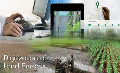
The Digital Land Records Revolution—An Introduction
India’s land administration has historically been fragmented, manual-intensive, and prone to corruption. Enter the Digital India Land Records Modernization Programme (DILRMP)—an unprecedented, centrally-funded mission launched in 2016 to revolutionize land record management across India. This initiative has triggered a tectonic shift, converting paper trails into digital databases, mapping land parcels with precision, and creating an environment where transparency isn’t just an ideal—it’s a standard.
Government Schemes Driving Transformation
From NLRMP to DILRMP: A Modern Leap
What began as the National Land Records Modernization Programme (NLRMP) in 2008 transformed into the fully-funded DILRMP in 2016. This revamped mission—backed with ₹875 crores from 2021–26—aims to be more robust, integrating Aadhaar, revenue courts, and real-time online access.
SVAMITVA: Drone-Based Mapping for Rural India
The SVAMITVA Yojana, launched in April 2021, empowers rural communities by mapping properties with drone tech. Over 310,000 villages are mapped, over 99 million parcels actioned, and millions of property cards have been issued.
NAKSHA: Digitizing Urban Land Records
Through the NAKSHA pilot in 150 cities (with ₹194 crore allocation), geospatial surveys are bringing order to urban land records. Andhra Pradesh alone completed aerial mapping of 9.5 lakh properties under this initiative.
Key Achievements & Milestones
- Rural digitization success: 95%+ of rural land records computerized, covering over 626,000 villages .
- Near-universal RoR and cadastral mapping: Over 98.5% digitized RoRs and 95% cadastral maps
Game-Changing Benefits
Transparency and Fraud Prevention
Digital records curb “benami” deals and unauthorized manipulation. Punjab’s Easy Jamabandi initiative, for example, notifies landowners of any change via WhatsApp or email, protecting NRIs and local citizens alike.
Reducing Disputes and Litigation
Digitization is making judicial processes faster by providing concrete, immutable records, alleviating court backlogs and reducing conflict.
Empowering Marginalized Landowners
Communities that once struggled with unclear titles now hold legal recognition. SVAMITVA’s rural mapping ensures equitable access and strengthens financial autonomy.
Investor Confidence and Economic Growth
Transparent, authenticated records entice investment. As the Economic Times notes, “big shift for realty” is underway, with digital property registration propelling the real estate sector.
Technological Innovations
- GIS, LiDAR & Drone Mapping: High-precision mapping brings granular accuracy—seen in Maharashtra, AP, Odisha.
- Portal Integration: Suites like Bhoomi, Mee Bhoomi, and e‑Dhara provide one-stop digital access to records.
- Aadhaar & Court Linkage: Linking land records to digital IDs & courts enhances uniformity and reduces recalls.
- Future Tech—Blockchain & AI: Academic proposals suggest blockchain can secure record integrity.
State-Wise Implementations & Success Stories
Uttar Pradesh: ₹46 Crores Released
UP’s allocation of ₹121 crores (₹46.45 crores released so far) is setting the stage for comprehensive digitization, with a whole suite of records being brought online.
Punjab: Easy Jamabandi
Beyond anti-fraud tools, Punjab’s system enables digital complaint filing, typo corrections, and subscription alerts—empowering citizens.
Kerala: Digital Resurvey & Ente Bhoomi
Digitally surveying land and launching the Thandaper ID, Kerala replaced multi-department portals with an integrated Ente Bhoomi portal, transforming transparency.
Andhra Pradesh: NAKSHA Pilot
Advanced geospatial and imaging tech is streamlining urban planning, tax assessments, and land record updates in 10 municipalities.
Odisha: Simplified Land Categories
Thanks to Bhulekh and Bhunaksha digital platforms, Odisha reduced complexities from over 7,797 land classes to just 22, simplifying transactions and boosting business.
Challenges & Road Ahead
Data Accuracy & Legal Complexities
Inconsistencies between digital maps and ground realities persist; legal frameworks need adaptation to digital-age norms.
Infrastructure & Digital Divide
Rural connectivity, hardware, training, and digital literacy remain critical for universal adoption.
Stakeholder Buy-In
Revenue officials, surveyors, and village authorities must transition from legacy systems and may resist change; widespread training and cultural shifts are needed.
Socio-Economic & Policy Impact
- Optimized Land Use & Disaster Management: Accurate mapping informs better urban planning and rehabilitation strategies.
- Policy & Planning: Real-time data boosts informed decision-making around agriculture, migration, urban growth, etc.
- Financial Inclusion: Authentic land titles facilitate access to credit, formal banks, and financial services.
What Citizens Should Know
- Online Access: Platforms like Bhoomi, Mee Bhoomi, and e-Dhara enable easy retrieval of RTCs and Khatauni.
- Security Alerts: Systems like Easy Jamabandi and subscription alerts help track any alterations.
- E-Registration: The new draft Registration Bill, 2025, envisions e-document submission and registration, replacing 117-year-old processes
Conclusion: A Digital Leap Towards Equitable Growth
From rural villages to urban metropolises, India’s digitization of land records is more than a tech upgrade—it’s a transformative journey. It’s about justice, clarity, citizen empowerment, and unlocking economic potential. While there’s more to do—be it legal realignment or infrastructure readiness—the foundation is strong, and citizen-friendly initiatives are spreading across states. India’s land governance is entering a new era—digital, decisive, and equitable.

